Walking along the Lake Sunapee Harbor in July, the first thing one notices are the tourists. Packed along the coastline, the wooden docks, and the restaurants and shops, families from New England and beyond flock to the picturesque harbor in the summers. Daily tour boats take the crowds around the eight mile stretch of water, and the few buildings in the harbor itself cater directly to the seasonal visitors. The scent of fried seafood and lobster waft through the air, and the once-empty parking lots fill up for a few short months. After living on the lake for almost a decade now, I’ve lived through and participated in these cycles firsthand. Drawing from this experience, my project will function as a place-based tour of the region, touching on the gentrification, habitat alteration, and landscape fabrication of the lake under the context of Sunapee’s burgeoning tourism industry.
The evolution of Lake Sunapee into a tourism magnet has been a gradual, oftentimes intentional process. Over the last thirty years, wealthy summer residents from Boston and New York have flooded the lake, pushing up property values and pushing out lower-income residents. This change is evidenced by the constant construction of large homes across the waterfront, and the demolition of older homes previously inhabiting the space. New restaurants have opened in response to this higher income population, and flashy sports boats increasingly dominate the waters. At the same time, however, the town of Sunapee has maintained its quaint New England atmosphere, its town center dominated by white wooden homes with dark shutters, historical society museums, covered bridges, and ice cream parlors to attract the new, authenticity-seeking population.
As this project will conclude, it is important to note that this rise in tourism has had tangible environmental consequences for the local ecology as well. From stocking the lake with invasive fish species for recreation, controlling the water level with local dams, to clearing acres of woodland for sprawling waterfront lawns, the town and its residents have made conscious efforts to create an air of ‘authenticity’ in their hunt for tourism. Negative environmental externalities of these alterations, such as eutrophication as a result of extensive lawn care and gardening, have impacted the biological cycles of the region as well. Overall, the landscape of Lake Sunapee represents far more than it presents at first glance, with scars of economic development, scenery fabrication, and habitat alteration at every corner.
Two buildings to the left of the above pin, Fenton’s Landing has persisted in the harbor for generations (albeit under different names). Nestled between the Sunapee Historical Society and the harbor’s tour boats, the quaint café embodies the fabricated scenery of the region. Despite the fact that Lake Sunapee is a freshwater lake and the nearest coast is hundreds of miles away, Fenton’s Landing proudly serves a variety of fish, shrimp, and until recently, clams and lobster (see menu to the right). These offerings are indicative of what the visitors expect upon arrival, a carefully cultivated preconception of New England that has been marketed for over a century.

As Dona Brown explores in her book, Inventing New England: regional tourism in the nineteenth century, New England has a rich history of developing ‘quaint,’ ‘natural’ and ‘romantic’ sceneries in its constant hunt for tourism 1. Like those of the White Mountains, Nantucket, or Pinnacle Hill, the developers of Fenton’s Landing (and more broadly, of Lake Sunapee) undoubtedly recognized the “‘savage’ and ‘romantic’ scenery that surrounded their home, and became adept at accentuating the ‘wild’ elements they knew would please their clients” 2. Indoctrinated to expect bountiful seafood, friendly locals, and far-reaching coastal views, tourists to New England demanded the very same elements from Lake Sunapee. As Dona Brown goes on to argue, “If a quaint atmosphere were in demand, it could be produced” 3. In addition to physical manifestations such as white gazebos, ‘five-four-and-a-door’ architecture, and a central town green, enterprises like Fenton’s Landing encouraged ‘scenic tourism’ by serving the very foods such visitors expected from a classic New England town. Even the name Fenton’s Landing, much like the Silver Cascade, Giant’s Stairs, or Sleeper’s Ledge of the White Mountains, conjures romantic associations in those that hear it.
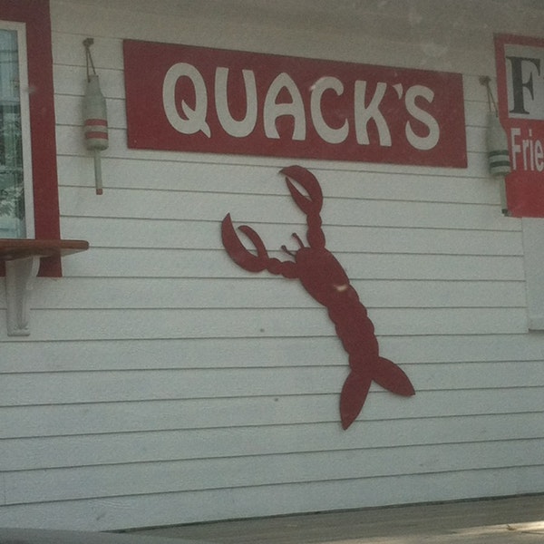
When I was sixteen, I worked as a fry-cook for one such ‘authentic seafood’ restaurant in the harbor. The main competitor to Fenton’s Landing, Quack’s Restaurant specialized in Maine lobster rolls and Duxbury oysters (again, the irony here is clear as Sunapee is hundreds of miles away from the ocean). For its services, Quack’s was able to charge a steep premium to the flocks of tourists each summer, and countless customers posed happily with their lobster rolls next to the wooden lobster by the store window (pictured left). Unbeknownst to the consumer, their ‘freshly-caught’ lobster had been frozen for days, only to be thawed out by yours truly three minutes before serving it. Nonetheless, in strategic recognition of what his customers sought, the owner of the restaurant, John Quackenbos, worked hard to cultivate this authentic New England scenery. His strategy, however, was nothing new to the lake.
The fabrication of Sunapee’s scenery dates back to the early 20th century. From 1915 promotional clippings by the Boston and Maine Railroad deeming Sunapee the “Ideal Resort for Recreation in the Mountains of New Hampshire,” to 1935 advertisements by the Boston Globe detailing the “Attractive shores luring many colonists” to the lake, the Lake Sunapee region has marketed a natural, escapist quality about it for years 4 5. In conjunction with its easy accessibility from Route 89 and Route 11, the infrastructure for tourism had already been primed. Indeed, by the early 1950s, the Dartmouth-Lake Sunapee Regional Association had already rebranded Sunapee “The Playground of Western New Hampshire” 6.
At the Sunapee Historical Museum, a small wooden building situated directly left of the above pin, additional evidence of scenery fabrication is found. Featuring artifacts, documents, and photographs from Sunapee’s grand hotel, steamboat, and manufacturing era of the early 20th century, the museum’s collection is most interesting in what it chooses to omit. Despite hundreds of historical items and biographies on display, the institution merely glances over the Soo Nipi. The Soo Nipi, the Native American tribe for which Sunapee’s name is derived, lived on the lake for generations before it was settled by European colonizers in the 18th and 19th centuries. However, other than a brief overview of their geography on the lake, Soo Nipi history, culture, and impact on the land is barely featured by the town.
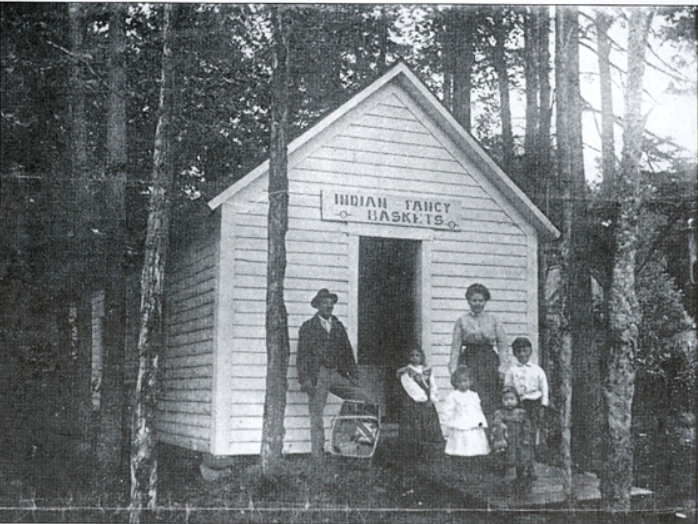
Even after turning to the web to learn more about the native population, what few articles I found were written under the context of white tourism. This photograph from the 1890s (seen left), for example, depicts a native basket shop on the eastern shore of the lake. Catering to “mostly summer visitors who wanted a pleasing souvenir to take home after a day of swimming or boating,” the native population strategically capitalized on the very same cultural currents that popularized the White Mountains 7. In a rapidly industrializing landscape, “‘quaint bygone places’ (like Sunapee) became newly attractive to tourists in the last quarter of the nineteenth century… preindustrial farm and village life” had become attractive to the urbanized middle-upper class of America 8. A century later, promotional clippings still frame the lake as “set apart from the clutter, bustle, and artificiality of our times…(an area that) has continued to retain and enhance the beauties and charms offered by nature herself” 9. In this way, the existing Soo Nipi community did what they could to adapt in this new world of market capitalism, only to be ushered out of their native lands as property taxes later rose through the 20th century.
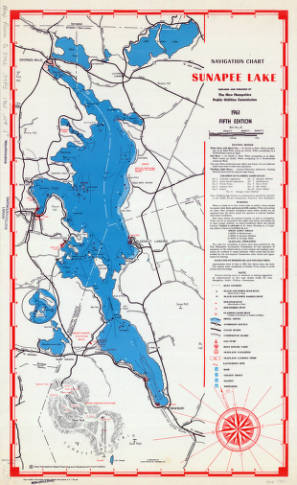
Precious little is said about the Soo Nipi on the Sunapee Tour boat as well. A double-decker cruise ship that sails twice a day in season, the ship is consistently packed throughout the summer months. As it meanders through the contours of the 8-mile waters (an aerial view of Lake Sunapee is provided to the right for reference), a pre-recorded loudspeaker spouts out facts sourced from the Sunapee Historical Society 10. A direct manifestation of the town’s cultivated scenery, the tour boat’s script reinforces the dominant, colonizing narrative found throughout the region. Just as Boston’s Back Bay was developed, gentrified, and cordoned off by the city’s powerful who “controlled the design and sale of the lands…ensuring both monetary rewards and an exclusive domestic enclave for themselves,” so was Lake Sunapee rezoned by the socioeconomic elite 11. In addition, it is important to note that a racial element exists in this comparison as well, as the ‘powerful elites’ in both cases were exclusively white, wealthy, European-blooded men. Using this bias to attract additional white tourism, railroad manuals from the late nineteenth century praise this racial history, proudly marketing that “more than two and a half centuries ago in 1630, the footprints of a white man were first impressed upon the sunlit shores of that regal sheet of cool and crystal water, Lake Sunapee,” only to expel the native ‘savages’ over time 12.
As Sunapee’s appetite for tourism grew, so did its reputation and subsequent capacity for vacation homes. At Garnet Hill Road, a well-developed and somewhat infamous peninsula on the center of the lake (pinned below), the influx of wealthy summer residents from Boston and New York is most prevalent. Trevania An, a longtime resident of Lake Sunapee, described the change in population as “a trend most everyone sees. Just look at Garnet Hill with its massive homes and waterfront properties. The property taxes alone on these places are $40,000, easy, and a new one goes up every other month!” 13 A longtime resident of Sunapee myself, I can attest that these new homes are generally bought by wealthy patrons from Boston and New York; few are local to the area. A testament to this observation, census data indicates the median family income of the area more than doubled from 1979 to 1989 alone (from $17,731 to $35,521) 14. Today, Sunapee’s median family income is over $66,000, slightly above the state average and markedly above neighboring towns Claremont (~$42,000) and Newport (~$45,000) who lack direct access to the waterfront 15.
The influx of wealthy, seasonal residents on the lake changed the region’s commercial landscape as well. Demanding luxury restaurants and stores in closer proximity, the new population directly influenced the construction of “first class, modern stores to satisfy their immediate and future materialistic needs…as well as evening theater and social entertainment to suit individual tastes” across the region 16. In recent years, for example, expensive fine dining options have popped up across the lake, including Millstone at 74 Main (est. 2014), Oak and Grain (est. 2011), and King Hill Kitchen (est. 2012). In addition, as described by geographer Scott C. Roper in A Landscape History of New England, in order to attract authenticity-seeking consumers, “community leaders (often) clamor to memorialize local historic sites that somehow connect their towns with pre-1840s New England” 17. Restaurant Oak and Grain exemplifies this strategy, prominently displaying the fact that it was “founded in 1790 by Caleb Segur…and later purchased by Union officer Colonel William Messer” on its online front page 18. Acting as a kind of positive feedback loop, expensive stores and restaurants such as Oak and Grain continue to attract wealthy residents, which in turn raise income taxes and contribute to the ongoing gentrification of Sunapee.
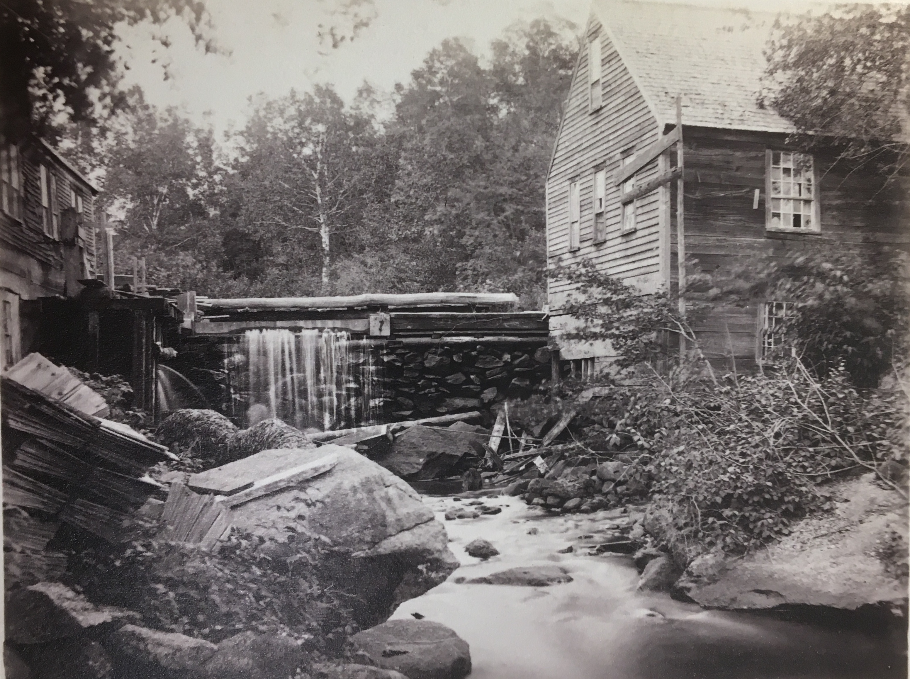
Sunapee’s rise in tourism has had tangible environmental effects on the landscape. As the picture on the right depicts, humans have been dramatically altering the environment since the 1800s. Originally used for milling purposes, the Sunapee dam now maintains a steady water level for the construction of vacation homes, offers flood control measures for resident safety, and enlarges the lake’s overall surface area for recreation. In conjunction, hundreds of acres of woodland have been clear-cut to make room for this steady rise in summer homes, and sprawling waterfront lawns are now visible from every angle on the lake. The maintenance of these estates, however, comes with negative externalities. Eutrophication, the excessive nutrient flow into a body of water causing dense algae growth and subsequent anoxia, for example, has been documented on Lake Sunapee since the 1970s 19. A direct consequence of extensive lawn care with nitrate and phosphate-rich fertilizers, unsightly colonies of cyanobacteria periodically spawn in the lake. Unpleasant, “slimy to swim through and a cause of skin irritations… cyanobacteria have an adverse effect on tourism and property values because of the aesthetics associated with people looking out on New Hampshire lakes” 20.
In addition to eutrophication, the developers of Lake Sunapee have been stocking the waters with invasive fish for decades. Fished for both sport and food, species such as the lake trout, Atlantic salmon, and brown bullhead catfish were introduced as a means of entertainment for Sunapee’s visitors and summer residents years ago 21. Other species, such as rock bass, were introduced accidently, directly competing with native species such as golden trout and driving them to regional extinction. Clearly, in their hunt for tourism, Sunapee’s developers created an air of ‘authenticity’ at the expense of local ecology. To maintain ecological stability and encourage a greater level of environmental stewardship moving forward, a greater understanding of Sunapee’s ecosystems and their relation to the human community must be established.
While the Lake Sunapee of today remains the child of landscape fabrication and habitat alteration, this realization is not necessarily a negative one. As geographer Kent C. Ryden explores in his article Big trees, back yards, and the borders of nature, learning that “wilderness is an invented idea…does not mean that the cause is lost, or that nature doesn’t exist…the benefits that people receive from visiting lands lightly touched by human hands are not invalidated” 22. Fabricated or not, Lake Sunapee remains a special place to those that live there, myself included. This project merely stands as a reminder to look beyond the scenery a landscape presents at first glance, and to think critically about its history and development.
Cover Photo Credit: NH Housing Solutions
Tiger Henderson is a member of the class of 2018 at Dartmouth College. He is a double major in Government and Environmental Studies and grew up in Dover, MA.
Dona Brown, “The Uses of Scenery” and “Manufactured for the Trade,” in Inventing New England: regional tourism in the nineteenth century (Washington: Smithsonian Institution Press, 1995), 41-74, 105-134. ↩
Brown 44. ↩
Brown 126. ↩
Boston and Maine Railroad. Lake Sunapee, the Ideal Resort for Recreation in the Mountains of New Hampshire. Boston: Issued by the passenger traffic department, Boston & Maine railroad, 1915. ↩
LAKE SUNAPEE: Attractive shores lure many colonists. 1935. Daily Boston Globe (1928-1960) 1935. ↩
A guide to the Dartmouth-Lake Sunapee Region, playground of western New Hampshire (map).1950. 45 x 32 cm. Dartmouth Library Digital Collections. http://libarchive.dartmouth.edu/cdm/compoundobject/collection/hanmaps/id/105/rec/1. (19 October 2017). ↩
Greenwood, John. ” Indian Basket Weavers.” Johngreenwood.net. Winter 2007. Accessed November 09, 2017. http://johngreenwood.net/Sunapee-History/index.html. ↩
Brown 108. ↩
Sunapee year ‘round recreation [map]. 1980. 44 x 28 cm. Dartmouth Library Digital Collections. http://libarchive.dartmouth.edu/cdm/compoundobject/collection/gsmaps/id/2076/rec/1. (19 October 2017). ↩
Navigation Chart: Sunapee Lake [map]. 1961. 66 x 40 cm. Dartmouth Library Digital Collections. http://libarchive.dartmouth.edu/cdm/singleitem/collection/gsmaps/id/1881/rec/4. (19 October 2017). ↩
Mona Domosh, “Developing Boston’s Back Bay” in Invented cities: the creation of landscape in nineteenth-century New York and Boston (New Haven: Yale University Press, 1996), 99-155. ↩
Boston and Maine Railroad, New York, New Haven, and Hartford Railroad Company, Boston and Albany Railroad Co, and Eastern Steamship Company. 1896. [Summer resorts ; Railroad manuals]. ↩
Trevania An, phone interview to author, November 6th 2017. ↩
Upper Valley Lake Sunapee Council, Economic Profile of the Upper Valley Lake Sunapee Region (New Hampshire: UVLSC, 1987), 2-70. ↩
“New Hampshire Employment Security.” Nhes.gov. Accessed November 4, 2017. https://www.nhes.nh.gov/. ↩
Sunapee year ‘round recreation [map]. 1980. 44 x 28 cm. Dartmouth Library Digital Collections. http://libarchive.dartmouth.edu/cdm/compoundobject/collection/gsmaps/id/2076/rec/1. (19 October 2017). ↩
Scott C. Roper, “Wrought in the Spirit of our Ancestors,” in A Landscape History of New England, ed. Blake Harrison and Richard W. Judd (MIT: MIT Press, 2011), 303-317. ↩
“Inn at Pleasant Lake: About Us.” Innatpleasantlake.com. 2017. Accessed November 8, 2017. https://innatpleasantlake.com/about-our-nh-inn.html. ↩
Lake Sunapee Protective Association and Jason M. Cortell and Associates. Ecological Study of Lake Sunapee: With Emphasis on the Threat of Excessive Algae Growth / Prepared by Lake Sunapee Protective Association 1972. ↩
McIntyre, Rick Ganley Mary. “Researchers to Study Toxic Algae Blooms in N.H. Lakes.” Nhpr.org. October 6, 2017. Accessed October 11, 2017. http://nhpr.org/post/researchers-study-toxic-algae-blooms-nh-lakes#stream/0. ↩
“What’s New…” New Hampshire Fish and Game Department. Accessed October 11, 2017. http://www.wildlife.state.nh.us/. ↩
Ryden, Kent C. “Big trees, back yards, and the borders of nature.” Michigan Quarterly Review 40, no. 1 (2001): 126–140. ↩