Tunnel Brook Notch is located in Benton, New Hampshire to the northwest of Mount Moosilauke and the east of Mount Clough. Presently, a four mile-long trail runs from its southern terminus at Long Pond Road to the north, connecting with a two mile-long road that was recently decommissioned. This project explores the history of Tunnel Brook Notch and its development from a six mile-long road into the half trail, half road we see today, as well as the decommissioning of Tunnel Brook Road following Hurricane Irene in 2011. The post doubles as a trail guide, with hiking directions from the Tunnel Brook South Trailhead to the North Trailhead, and along Tunnel Brook Road to the 2011 closure.
From Hanover, cross the bridge into Vermont and get on I-91 N. Take exit 16, then follow the signs to NH-25 E toward Benton. Turn left on High Street, then left again on Long Pond Road. Park before the bridge.
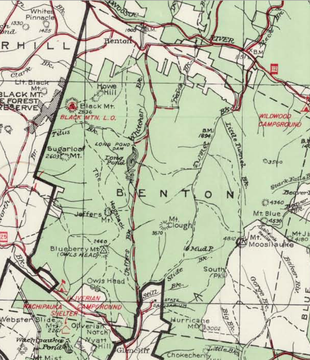
The map above shows the location of Tunnel Brook Notch, which is a part of White Mountain National Forest, and some important landmarks along the trail and the road.
The charter to establish Benton, originally called Coventry, was granted in 17641. The area was not very attractive to settlers because of its mountainous topography, so settlement occurred in patches, mainly near the Warren town line1. The original name of the settlement came from Coventry, Connecticut, where many of the first settlers were from2. After a while, the name “Coventry” became associated with backwardness, and the town was renamed after Senator Thomas H. Benton, a Democrat from Missouri2. The peak of population in Benton occurred between 1835 and 18702. After this period, many settlers emigrated to the West or to industrial centers in southern New England, leaving abandoned farms and roads12. Cleared land, formerly used for farming, slowly turned back into forest2. By 1905, Benton was one of the smallest towns in the state1. In 1935 the population was reduced to about 400 people2, and hovers around this number today3.
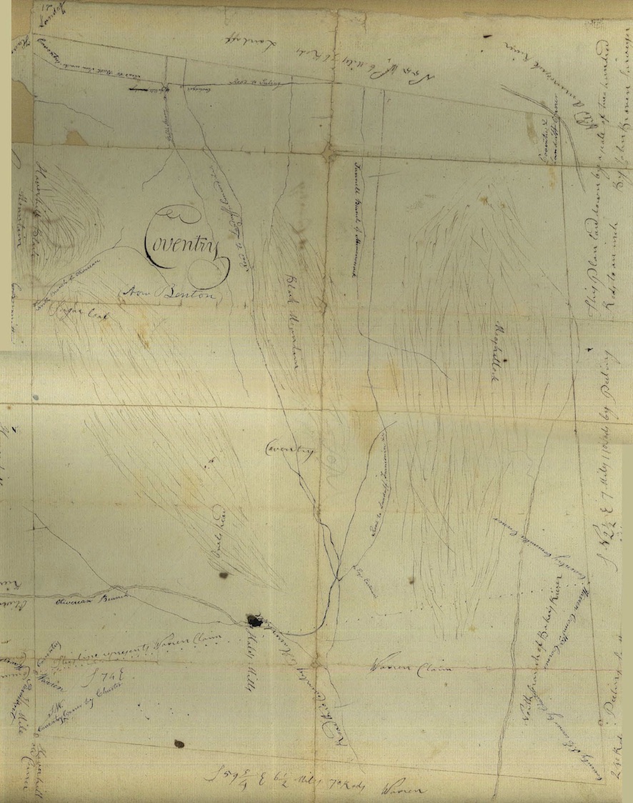
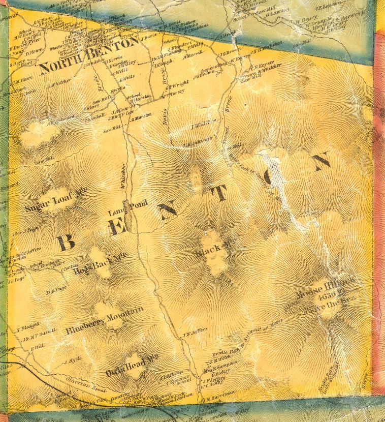
The 1805 map below shows a preliminary sketch of Benton. The 1860 map clearly shows that the northern two miles of Tunnel Brook Road were already built at this time, and follow the track of the modern road. Although there was a saw mill and several residences at the northern terminus of the road, no settlers lived along the road itself. Mud Pond, a series of beaver ponds present in the notch today, did not exist at this point. The 1860 map is also interesting because it misnames Mount Clough as “Black Mountain,” which is actually the unlabeled feature on the map to the north of Sugar Loaf Mountain.
Leave the car and head down Long Pond Road, a wide roadway through the forest that has been closed for several years. Walk for about five minutes until you reach the Tunnel Brook South Trailhead on your right. The sign tells you that the trail is 4.4 miles long. Walk along the trail for two miles, crossing Slide Brook, a small stream, several times.
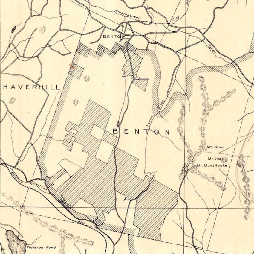
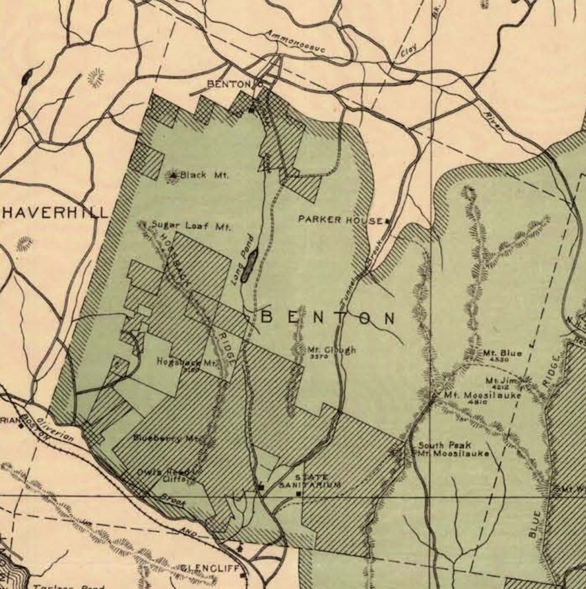
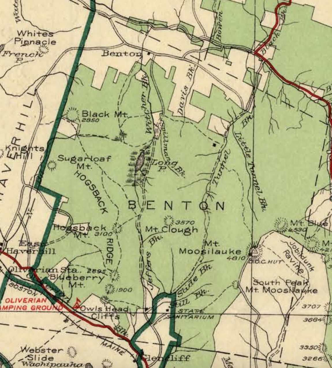
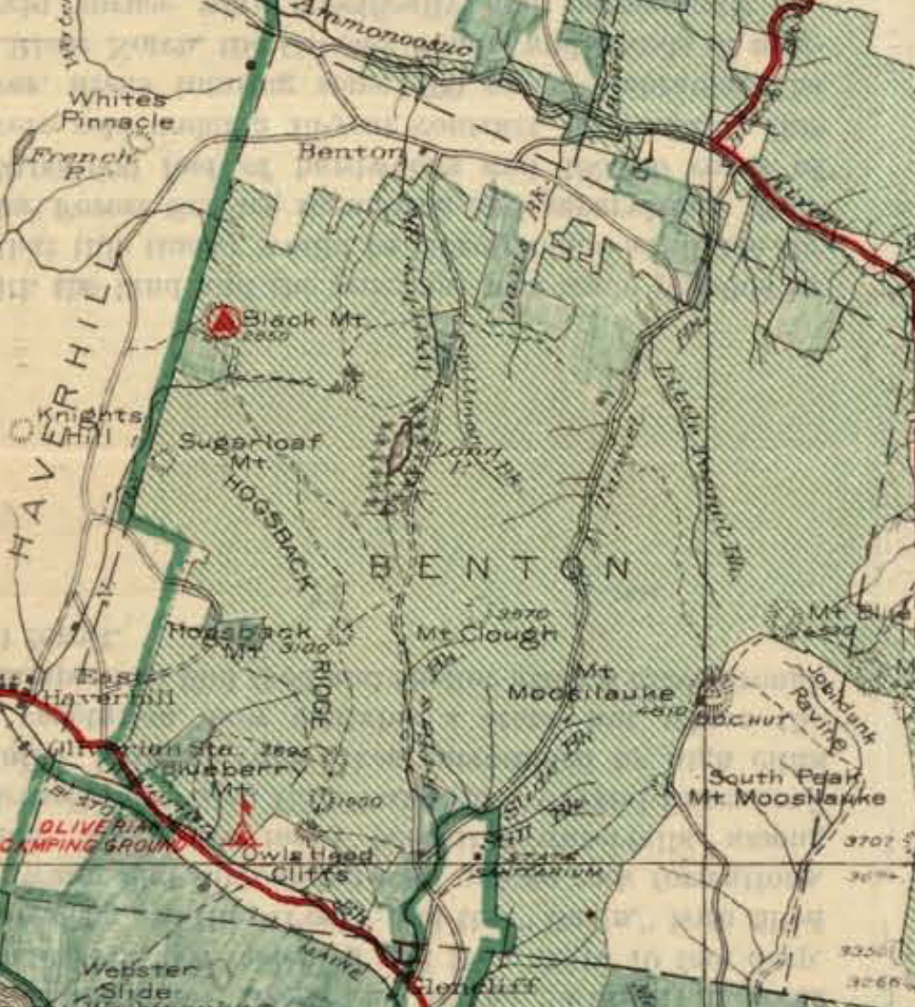
A century ago, this trail was a road running through Benton, open to through traffic to connect Warren in the south with Easton in the north. The map from 1902 shows how the town of Benton looked in that year. Many of the mountains known today are labeled, including Mount Clough, Blueberry Mountain, and Moosilauke; as well as trails such as Benton, Glencliff, and Carriage Road, which then was open to traffic as well. It is apparent that the modern split between Tunnel Brook Road and Trail was present in 1902. The paved road went right up to the Benton Trail, and while the waterway Tunnel Brook is marked, no footpath is labeled where the modern trail is today. The 1902 road almost corresponds to the road that was washed out during Hurricane Irene; the modern road continued about a half mile further to the Tunnel Brook North Trailhead.
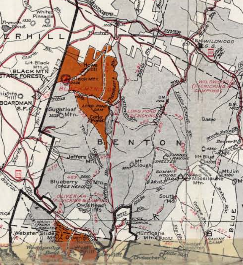
A collection of maps produced by the United States Forest Service gives clues as to when and where the original road was built. Focusing on Tunnel Brook Notch, the first map from 1914 is very similar to the 1902 map: Tunnel Brook Road extends to the Benton trailhead, and no Tunnel Brook trail is marked. In the 1915 map, the whole stretch from where the road begins today at its northern terminus to the southern end of what is now Tunnel Brook Trail is labeled as a road. So, the road was completed some time in between the production of the 1914 and 1915 maps. The Parker House, a hotel near the Benton Trailhead, is labeled on the 1920 map, but not in 1924.
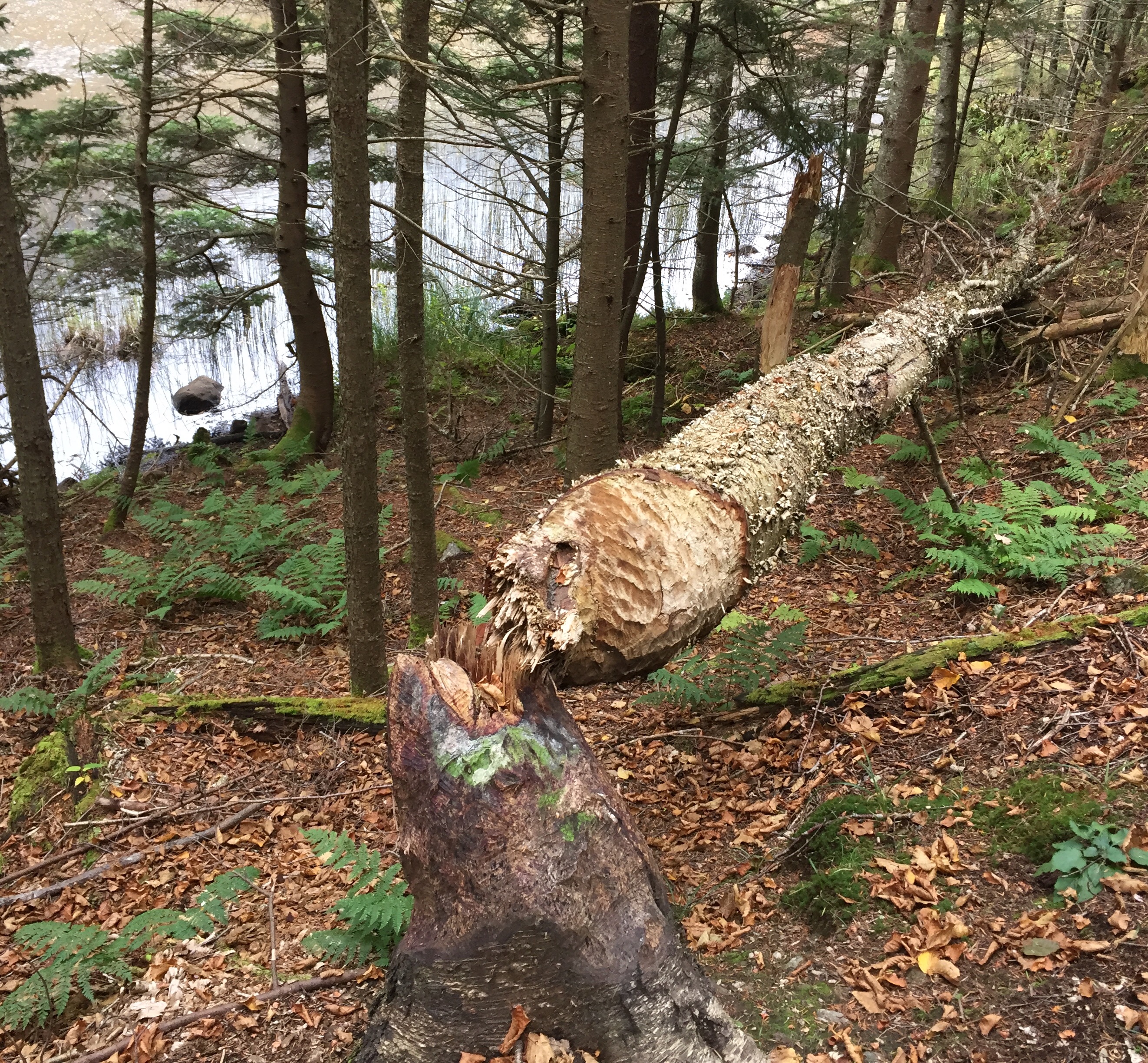
As you hike, you notice that the trees on either side of the trail are very young. The trail climbs slightly and brings you to Mud Pond about two miles in. You begin to see evidence of beaver activity, including dams and chewed, felled trees. Gaps in the forest give you views of Moosilauke to the right and Clough, with its long, unmarked slide trails, to the left.
The area around Tunnel Brook occasionally featured a few farms and several mills4, and has also been logged periodically throughout the nineteenth and twentieth centuries5. The USFS maintains this and other regions as general management areas, which are open to logging as well and recreation6. To maintain the look of a “young forest” -one that is ten years old or younger- an area will be logged every fifteen to twenty-five years6. During the first half of the twentieth century, there were logging camps in Little Tunnel Ravine, near the old Parker House site, at the mouth of Tunnel Brook, and to the south of Mud Pond7. Currently there is one active contract in the area that operates during the winter6.
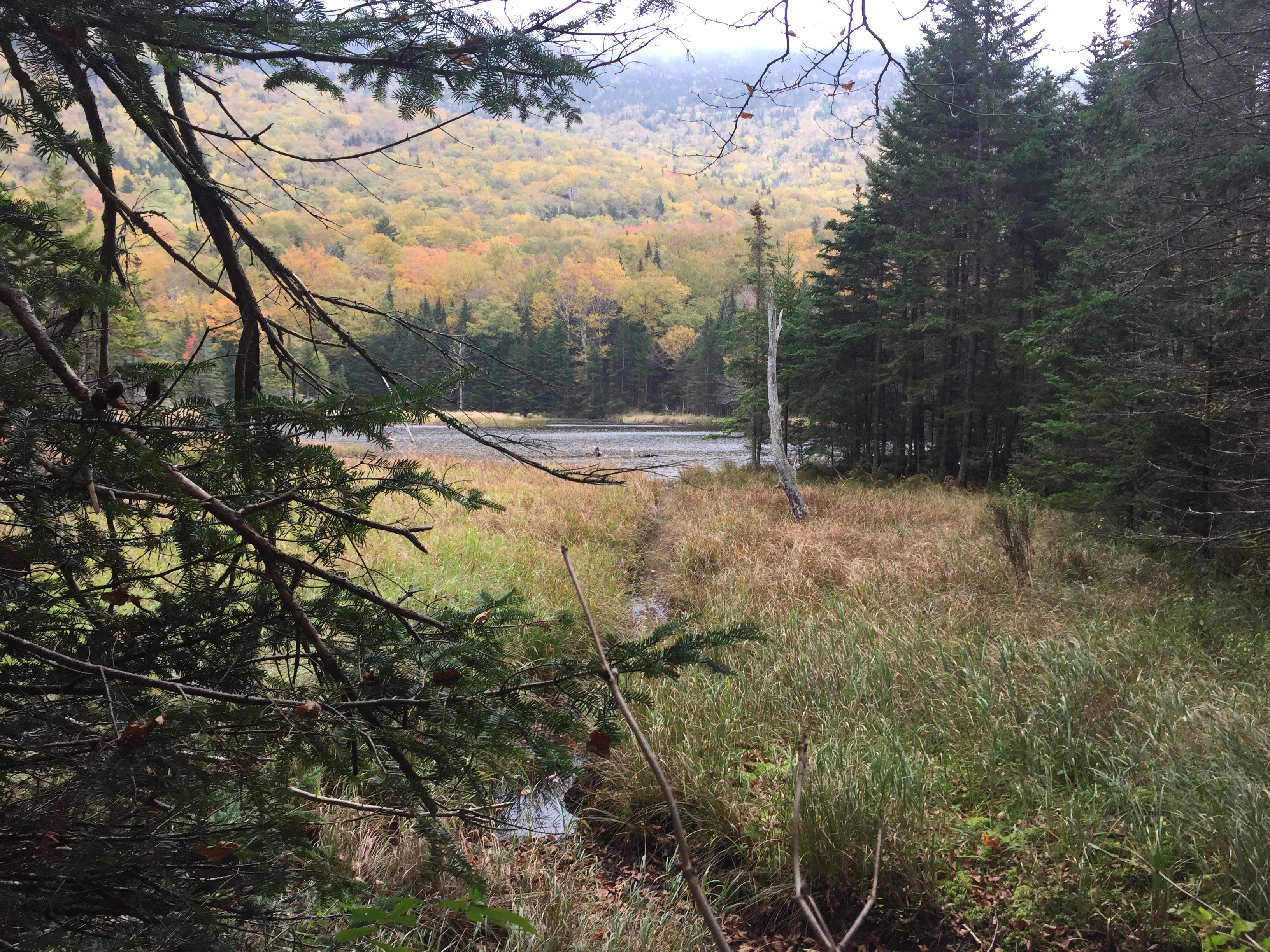
Mud Pond is the southernmost in a series of beaver ponds stretching along the valley between Mount Moosilauke and Mount Clough. The other ponds are unnamed but are just as big and beautiful as Mud Pond. The ponds are the result of beaver activity in the area, and each distinct pond is separated from the next by a dam or vegetation. There are several trees along the trail that have been felled by beavers, as evidenced by the distinct markings on the trunk. The trail runs along the ponds for about a mile. There have been several reroutes through the forest over the years due to storm damage and pond flooding. Because the trail is not used as often as it used to be when the road was open, there are some points when the path goes unmarked and is difficult to follow.
Continue hiking along the trail, passing beaver ponds to the right and left, for another two miles until you reach Tunnel Brook North Trailhead. Here, the forest opens into a paved parking area. Cross a short bridge and keep walking on the wide, gravel path, surrounded on both sides by trees.
The northern trailhead marks the divide between the modern Tunnel Brook Trail and Tunnel Brook Road. After the old road, which stretched across all of the modern trail and road, was decommissioned, the southern four miles were converted into a pleasant trail and the northern two miles remained a road.
Over the years, the trail/road divide has shifted. This story is told by a series of maps produced by the United States Forest Service, a selection of which appear below. The 1924 map shows that the entire road was intact during this year; in 1929, the southern half of the road disappeared. However, the entire road is present on the 1931 map and is labeled as a “good motor road,” so maybe there was an attempt to rebuild the road before it was abandoned for good. Some bloggers report that the road was closed due to flooding and landslides, but this speculation is unconfirmed8. The 1937 map shows the same road/trail divide as the 1902 map, which is slightly different from the most modern divide. This year is also the first that Mud Pond appears on the map, along with Tunnel Brook Slide Trail, which led from the ravine up to the summit of Moosilauke. After a devastating hurricane in 1938, much of the White Mountain National Forest was closed to foot traffic, including Tunnel Brook Trail, but the area was reopened by 1941. The Benton Trail was still accessible via the road. 1941 is the first year the motorway, still about a mile and a half long, is marked as a “poor motor road,” presumably due to the destruction caused by the hurricane. This is also the first year that shows the Tunnel Ravine shelter, a former Dartmouth Outing Club structure that is gone from the map by 1963. The 1963 map shows that the road was actually abandoned due to its poor condition; only a small section in the north is still open, and was still labeled a “poor motor road.” In 1967, the Tunnel Brook Slide Trail is no longer marked. By 1982, the road re-lengthened so that the road/trail divide is the same as it is today, with parking at the Benton Trailhead and at the Tunnel Brook North Trailhead. So, based on this series of maps, it is safe to say that the modern road was finalized sometime between 1967 and 1982.
Walk another half mile down the flat gravel path to reach the Benton Trailhead, which leads to the summit of Mount Moosilauke.
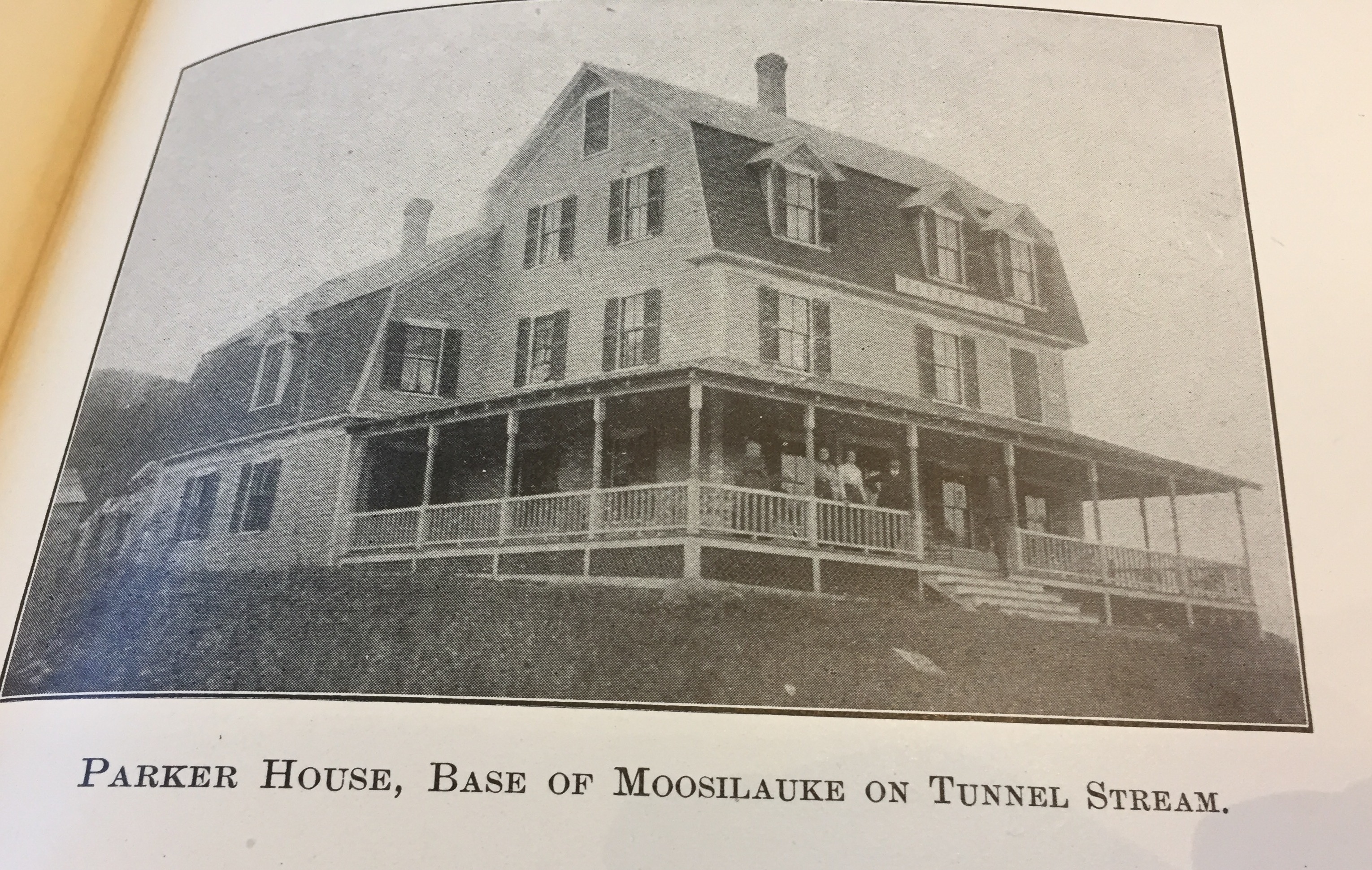
The Benton Trailhead is an old bridle path that connects with the Beaver Brook Trail to reach the Moosilauke summit. Nearby is the old cellar hole of the Parker House Hotel, which existed from 1904 until the mid-1920s. Grafton County granted Lebina H. Parker a license for this hotel in 19049. The building was three stories high5 and could hold up to forty guests at a time2. Single rooms cost $8-12 per week, or $2 a day2. For a small fee, the proprietor could meet guests at the railroad depots in Woodsville, Wells River, or Glencliff2. Guests enjoyed a cozy parlor, hot water, bathrooms, croquet and tennis courts, and daily mail deliveries2. The business survived into the 1920s2, but at some point in the middle of the decade, the business failed, and the building was burned by the town after 19305.
There are a total of fifty eight heritage sites in the area, including cellar holes, barn foundations, stone walls, and wells4. Most archaeological sites are hidden by high vegetation, but several, including the Parker House cellar hole, an old Model T Ford, and the remains of several mills, are still visible today4. A few Dartmouth Outing Club trails and structures were built and abandoned in Tunnel Brook Notch throughout the first half of the twentieth century, including the Tunnel Brook Shelter. This small camp was built sometime before 1929, but its origins are unknown as no records of its construction exist10. Today, the Benton Tunnel Brook Trails are still used for recreation, but the closure of Tunnel Brook Road have made them more difficult to access.
Continue past the Benton Trailhead. The gravel road transforms into an overgrown path through high grass. Be sure to check for ticks after this section. The trail then swerves left to take you through the forest, and then deposits you onto a wide, rocky area that was the site of flooding during Hurricane Irene in 2011.
Tunnel Brook Road was destroyed in 2011 by Hurricane Irene. The road was flooded by the overflowing Tunnel Brook, which dumped both water and rocks onto its bank and caused the road to collapse11. Where there used to be a road there is now only a dry strip of washed-out riverbed, filled with rocks. According to fisheries biologist Mark Prout, when the road was built for the first time about a hundred years ago, the water level of the stream was much lower11. As years have gone by, floods and landslides brought more sediment into the stream, causing the water level to rise11. The elevation of the road stayed the same, making it more susceptible to flooding11.
Restoring the road would not be time or cost effective, as workers would have to dredge the stream and build the road at a very high elevation to prevent further flooding11. The United States Forest Service fears that future repairs to the road would only become more costly because of the effects of climate change11. Instead, Tunnel Brook Road was decommissioned, and the USFS plans to facilitate its return to a more natural state11. During 2014 and 2015, the asphalt that remained from the road was removed, and this land was covered in organic material and revegetated11. While cars used to be able to drive all the way from the highway to the Benton Trailhead and then to the Tunnel Brook Trailhead, they now must park at the road closure and hike in. Hikers can travel an extra 1.5 miles on the wide, gravel path to reach the Benton Trail, and then a further half mile for Tunnel Brook Trail. Reportedly, the forest service will be building another road on east side of Tunnel Brook that will be open to public for foot traffic6.
The USFS produced the video below, which further explains the decision to decommission the road as well as the process of returning the former road to a more natural state.
You have reached the end of the trail and the parking area.
The road walk ends at the new parking area, built after the road was decommissioned. To return to the parking area south of Tunnel Brook Trailhead South, one must either walk the six miles back along the trail or drive a circuitious twenty two miles around the mountains surrounding the trail. For this reason, the old road was extremely useful; it provided a direct route through the mountainous town of Benton, connecting the more populated centers of Warren and Easton.
Even though Tunnel Brook Road is now decommissioned, the entire length of the trail remains a beautiful recreational area that is used for hiking, mountain biking, birding, and picnicking. Tunnel Brook Trail provides access to the scenic beaver ponds as well as trails (both marked and unmarked) to the summits of Mount Moosilauke and Mount Clough. Both the United States Forest Service as well as local historians are optimistic that Tunnel Brook Notch will remain a popular spot for years to come.
“Benton may be small, but there are those who love the old town, and are confident of her future1.”
Dru Falco is a senior at Dartmouth College studying linguistics and Italian. She is the current chair of Cabin & Trail, the hiking division of the Dartmouth Outing Club.
Cover image source: Dru Falco
Whitcher, William F. Some things about Coventry-Benton, New Hampshire. Woodsville, NH: News Print, 1905. ↩ ↩ ↩ ↩ ↩
Brigham, TP. Some more things about Coventry-Benton, New Hampshire. Benton, NH: 1964. ↩ ↩ ↩ ↩ ↩ ↩ ↩ ↩ ↩ ↩ ↩
“Benton, New Hampshire Community Profile.” New Hampshire Employment Security. Accessed 11/15/2017. ↩
Nutt, Edgar Alan. “Coventry-Benton Revisited: A supplement to William F. Whitcher’s 1905 “Some Things about Coventry-Benton, NH.” Benton, NH: self-published, 2004. ↩ ↩ ↩
Boyer, Roger and Mark Prout. Phone conversation. October 23, 2017. ↩ ↩ ↩ ↩
Brown, J. Willcox. Forest History of Mount Moosilauke. Medford, NH: Cabinet Press, 1989 (original work published in 1941). ↩
Parsons, Ed. “Peaceful walk along Tunnel Brook Trail.” The Conway Daily Sun. Published 8/7/2015, accessed 11/15/2017. ↩
Neal, George G. (binder). State of New Hampshire Reports 1903-1904. Volume III, Concord NH: 1904. ↩
Hooke, David. Reaching that Peak: 75 Years of the Dartmouth Outing Club. Canaan, NH: Phoenix Publishing, 1987. ↩
United States Forest Service. “White Mountain Tunnel Brook Road.” Youtube Video, 24:00. Posted June, 2017. ↩ ↩ ↩ ↩ ↩ ↩ ↩ ↩